We use cookies to make your experience better. To comply with the new e-Privacy directive, we need to ask for your consent to set the cookies. Learn more.
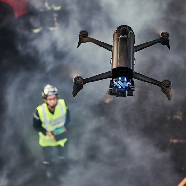
Time is of the essence when searching for missing persons.
The professional Parrot solution provides both an overview of the monitored sites and a quick inspection of the different areas.
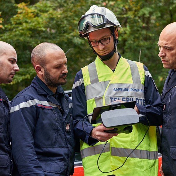
During a fully autonomous flight, the drone takes photos and videos that are immediately visible from the screen of a smartphone or tablet.
No knowledge of flying drones is required to manage this. Thanks to the images taken from the sky, teams can observe the site over an extended distance.
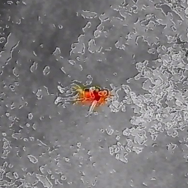
The drone is also equipped with infrared sensors that can switch from conventional video to thermal vision. An essential feature for identifying heat differences and locating people
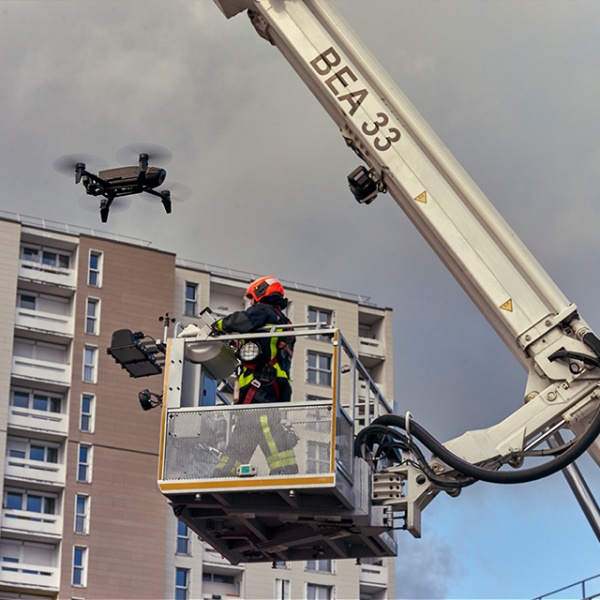
The professional Parrot solution enables teams to make more reliable decisions based on data with increased readability and accuracy. Thanks to the images captured at altitude or in difficult to access areas, agents benefit from an exhaustive and rapid view of the locations. Determining and innovative elements for faster action. Our DGAC approved drones play a key role in the action.
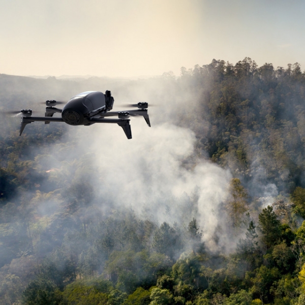
The Professional Parrot solution makes it easy to locate and analyze fire risk areas.
Equipped with a thermal camera, it can display both real and thermographic images in color. Easy to use, it allows you to plan flights in advance to capture images in the places you want.
The Professional Parrot solution generates a precise scan of surfaces and materials, allowing firefighters and other key people to collect the information required for a diagnosis.
No flying knowledge is required. The photos and videos taken by the drone can be accessed from a smartphone or tablet, making discussions in the field much easier.
The Professional Parrot solution gives teams a first assessment of buildings and forests on fire.
Thanks to infrared sensors, the speakers can switch from conventional video to thermal vision. An essential feature for identifying heat differences, locating homes, evaluating access, monitoring the evolution of the fire and preventing hazards.
The drone retransmits live images. The user can adjust the altitude at which flyover takes place according to the height of the flames.
Teams can carry out a thermal analysis of locations and buildings.
The first agents on the scene can then make decisions quickly and increase their efficiency. Because Parrot technology can be used in emergencies, preparing for action is even faster.
The data and images collected by the drone are mapped and georeferenced, and can be viewed live from a smartphone or tablet.

Construction industry and public works professionals; experts in civil security and rescue services; energy producers and transporters and environmental protection officers; ANAFI Thermal is the complete drone solution, adapted to all your needs. Even in complex environments, you can easily and safely take thermal and visual readings. You are more efficient, more precise, more responsive.
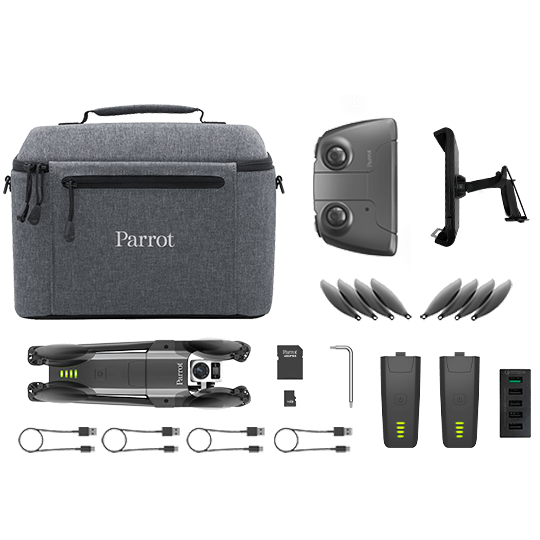
An all-inclusive pack:
Drone + Dual sensor (Thermal and RGB) + Control and analysis app
• Only 315g and a unique foldable design so you can take it anywhere;
• 2 cameras: Thermal FLIR® and 4K HDR with 21MP Sony sensor. 3-axis stabilisation and +/-90° tilting to observe right underneath structures;
• up to 78 min of accumulated flight (3 batteries);
• easy to use thanks to the FreeFlight 6 app.
FLIR and LEPTON are registered trademarks of FLIR SYSTEMS Inc